
The Society owns a collection of over seventy estate maps for various places across Bucks. These are deposited for safekeeping at the Centre for Bucks Studies (CBS). Through a bequest from Professor William Mead, a previous President of the Society, these maps have been scanned at a high resolution and are being made available on this website for anyone to see. You may also see the originals as well as the high resolution original scans at the Buckinghamshire Archives
At present only a sample selection are included for view here although all have been scanned. An additional few maps, not part of the’s Societies collection, have also been scanned and will be included here.
A detailed list of all the scanned maps has been made. for most maps this includes, a general description, the date of the survey, additional information including the surveyor, and a physical description. A hand list of Bucks estate maps was published by Bucks Records Society in 1963 (with subsequent amendments).
The links below provide some examples of the 70+ maps available, while we establish the best resolution and image enhancement for online display. The display will depend on your browser. In MS Edge, the toolbar for this viewer can be accessed by a right click on the image. In Chrome, we suggest using the enhanced PDF viewer.
C16 Doddershall Estate Plan This map is a scanned version from a photograph of the c16th map in Doddersall house and includes what is now the deserted village. (Courtesy Christopher Prideaux.) Because this area will be severely impacted by HS2 the Society has produced a number of reports and submissions on Doddershall.
Amersham & Coleshill 1637 This map covers a part of Amersham on the east side of Gore Hill and part of Coleshill. It is probably the land of Amersham Manor sold by the Earl of Bedford to William Drake (see CBS D/DRD/2/22.)
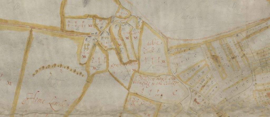
Ashendon [1624] Described as being a map of the Manors of Great Pollicot and Little Pollicot belonging to Lincoln College Oxford and dated 1624.
The Lee etc 1909 Labelled as “The Lee Manor Estate, Sheet A” dated July 1909 and described as being in the parishes of The Lee, Gt.Missenden, Wendover, Chartridge and Aston Clinton.
Pitstone 1809 Labelled as “Part of the parish of Pightlesthorne ( East of the Open Fields) 1809.
Stoke Mandeville C19 This map has the CBS reference 612/28 and is only a few fields in extent.
A larger collection of Maps (including the BAS map originals) can be found by visiting Buckinghamshire County Archives.