
A news item from the BBC:
A collection of aerial photographs described as the “historical Google Earth” has been made available online by the University of Cambridge. RAF pilots were asked to capture the bom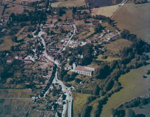 b-scarred post-war period to the emergence of motorways and new cities. The collection dates back to 1945, with more recent images captured in 2009 for a university project. The first 1500 images of 0.5million are now available on the Cambridge Digital Library http://cudl.lib.cam.ac.uk/ including this one of Dorchester on Thames in 1948.